Govt Warns Kenyans Of River Rapture Leading To Flooding In 16 Counties
The CS revealed that the Seven-Forks Hydro-electric Power Dams are filled up as of Wednesday morning.

Interior Cabinet Secretary (CS) Kithure Kindiki on Wednesday, April 17 warned members of the public that the current weather forecast for the ongoing long rains presents the potential for flooding and may require the issuance of evacuation orders in various parts of the country to secure public safety.
In a statement, the CS revealed that the Seven-Forks Hydro-electric Power Dams are filled up as of Wednesday morning.


In particular, Masinga Dam, which is the first, largest and most consequential of these dams, is already spilling through the managed structural spillways.
"However, the Masinga Dam spillover does not present obvious spillover effects into the cascade dams of Kamburu, Gitaru, Kindaruma and Kiambere.

Interior Cabinet Secretary Kithure Kindiki visits the Masinga Dam on April 17, 2024. /KITHURE KINDIKI
"This notwithstanding, any further precipitation is likely to cause the spillover to cascade to the other dams with greater flooding effects being likely in the settlements contiguous to the last dam-Kiambere," stated Kindiki in part, having paid a visit to the dam itself.
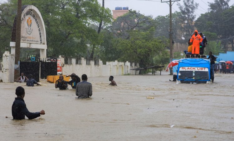
He cautioned that the likely event of further precipitation within the Tana River and River Thiba catchment areas in the coming days, River Tana is likely to burst its banks downstream leading to significant flooding in Garissa, the Tana Delta and Lamu Counties.
The CS specified that in Western Kenya, communities along lakes and rivers in Homa Bay, Siaya, Busia, Nyando, Nyakach and Muhoroni as well as low-lying areas in Migori, Kakamega, and Vihiga risk flooding if the quantity of daily precipitation increases beyond the prevailing levels.
Equally, at the risk of significant flooding are low-lying areas in Narok, Kajiado, and Mombasa as well as hilly areas traditionally prone to mudslides, particularly in Makueni, Nyeri, Murang’a and West Pokot Counties.
Urban areas with clogged or poor drainage, and public or private water reservoirs across the Country may also flood if the precipitation continues uninterrupted in the coming days.
The risk of significant flooding in various parts of the country has put the government on high alert. Accordingly, the public was notified to exercise caution, plan their movements and avoid risky behaviour in moving waters.
Kindiki assured that the government has taken proactive measures to ensure public security and safety and is prepared to mitigate any adverse effects of flooding in the country.
"This morning, the National Disaster Operations Centre (NDOC) at the Ministry of Interior and National Administration has reconvened the Multi-Agency Disaster Management Team which was established during the 2023 El-Nino rains to ensure a coordinated, whole of Government approach to monitoring the current situation and organizing Government response programmes.
"The Kenya Red Cross Society and relevant National and International humanitarian agencies have been co-opted to work with the Government to provide a coordinated response," he added.
The CS directed County Security and Intelligence Teams across the country to work with County Governments to monitor and report situations and to support the interventions of stakeholders.
This, he said, will ensure that the Country mitigates against loss of human or livestock life and the destruction of public or private property.
"Should the situation demand, the Government will issue mandatory evacuation orders in specific areas in the interest of public safety," Kindiki added.